Re-Site: Dreamcatcher: A Heart as Big as the Ocean and as Bright as the Sun
Shane Charles
Shane Charles
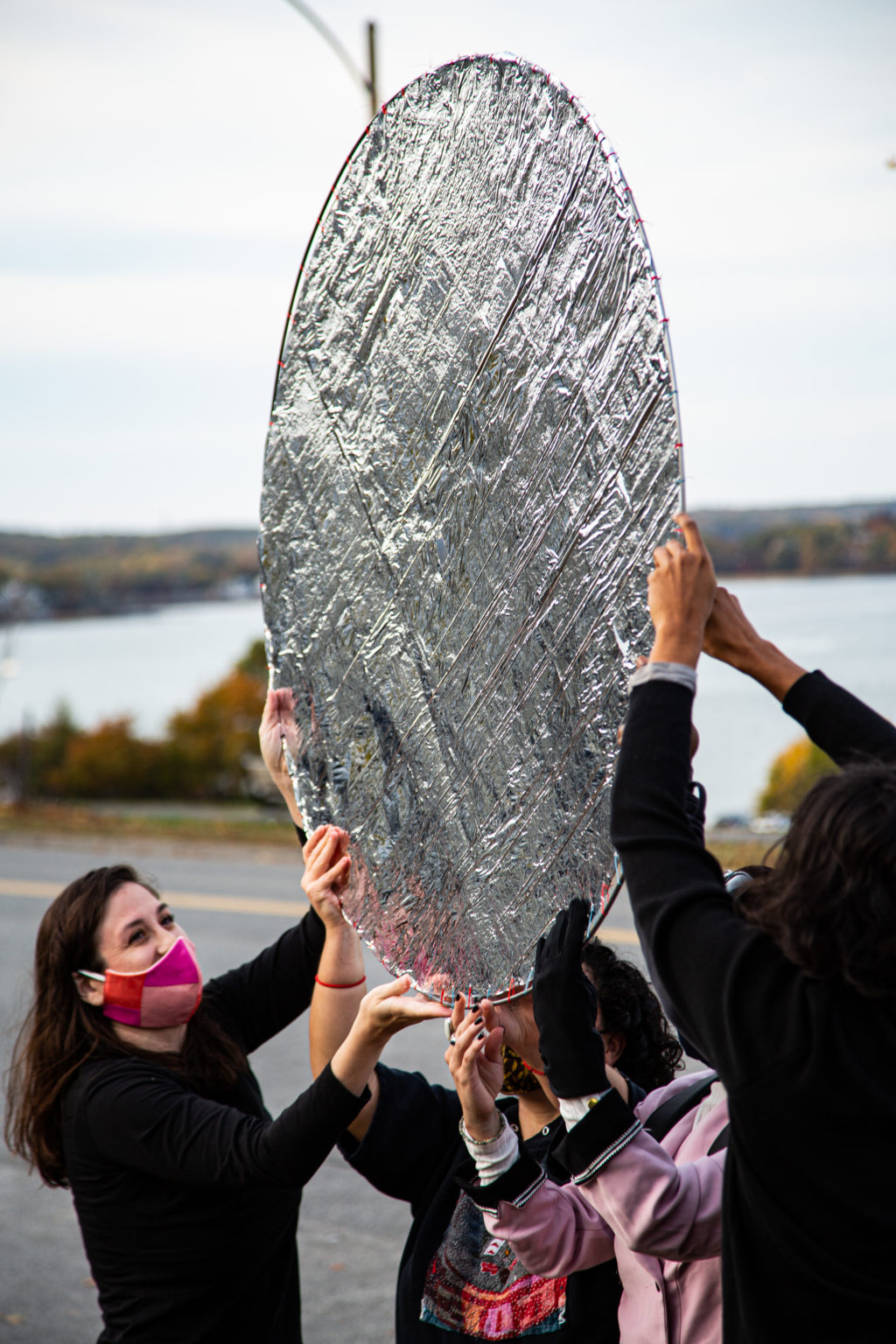
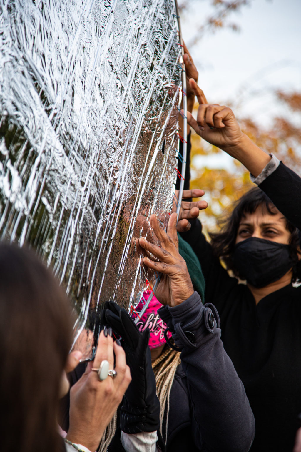
Dreamcatcher: A Heart as Big as the Ocean and as Bright as the Sun
Performance for video with welded metal and rescue blanket on stitched fabric
150 Eastern Promenade
October 18-19
Artist Statement
This piece reflects who we are in the shifting light of the Sun. The circle represents community, a unity, a gathering. Moving together, actors twist the sun that falls on the mirrored surfaces, in fractured tessellations. This act of rotating the mirror bands together the participants. All people are touched by the sun, it’s warmth and the light of it. The rescue blanket represents the climate in crisis. The sun reflects above and on top of those holding the mirror up. We are in a time when global warming is a common threat. The sun filters through this shield, which is stretched like a drum…the light still flows through, penetrating the bodies of the dancers.
Dreamcatcher: A Heart as Big as the Ocean and as Bright as the Sun is meant to honor the enduring Wabanaki spirit of courage, fortitude, and perseverance. The object and action is meant to invoke a meeting place, as if a drum circle. I intend for this performance piece to exist as filmed documentation on social media, specifically Instagram.
This project was inspired by Artist Cannupa Hanska Luger’s 2016 work, The Mirror Shield Project which was initiated for and at Oceti Sakowin Camp near Standing Rock, ND.
Click here to read more about Re-Site.

A note on historical narratives
The histories that ground the Re-Site have been cultivated from primary and secondary sources, accessible with thanks to the on-going efforts of collecting organizations and libraries, community members, and historians. The stories that define people and place shift in the currents that pull our socio-cultural priorities: they ebb and flow. Our knowing is reliant on those who have preserved records and have previously woven those pieces together, but we must always be mindful of the records not archived, the voices obscured and silenced, and the perspectives we have neglected and forgotten. History is happening right now.
Site History: Indigeneity and Casco Bay
This site offers a sweeping view of the Eastern Promenade, Portland Harbor and Casco Bay, as well as the surrounding islands. The house at 150 Eastern Promenade was built in 1909, four years after the Olmsted Brothers landscape firm designed the public park across the street. Due to its expansive vista and proximity to river tributaries (the Presumpscot River to the north and the Fore River to the south), coastal byways, and island habitats, this site offers an opportunity to recognize and honor the current Tribes who comprise the Wabanaki Confederacy—the Penobscot, Passamaquoddy, Maliseet, and Mi’kmaq peoples—who have stewarded this land throughout the generations. Though, due to generations of genocide and violence, Maine’s Indigenous communities center themselves further North in the state, this site nonetheless offers opportunities to consider Indigenous relationships to land and water. Today, the Eastern Promenade is a public park with the only public access beach and boat launch on the peninsula of Portland and the properties are some of the most highly priced homes in the area.
Eastern Promenade
The Eastern Promenade was designed in 1905 by the Olmsted Brothers landscape firm, renowned for creating New York’s Central Park and the Boston Commons. Today, the 68-acre historic landscape on the northeastern slope of Munjoy Hill (east end of Portland peninsula) offers unparalleled views of Casco Bay and Portland Harbor, as well as abundant opportunities for public recreation and enjoyment in all four seasons.
Wabanaki Confederacy
Today, the Wabanaki Confederacy, a First Nations and Native American confederation of five principal nations: the Mi’kmaq, Maliseet, Passamaquoddy, Abenaki, and Penobscot, maintain an active maritime culture – hunting, fishing, and gathering. Many Wabanaki consider the earliest occupants of Casco Bay to be their ancestors. Native peoples depended on Casco Bay Estuary, an extremely productive natural habitat. The Estuary’s ten foot tides swept salt water upstream into freshwater streams, coves, and marshes to nurture abundant marine life: seabirds, shellfish, lobsters, fish, and sea mammals.
Prehistoric spear and harpoon points, fish bones, and shell heaps found on Casco Bay islands help trace ancient peoples’ late winter, spring, and summer camps. While evidence of ancestral Wabanaki dates back 2000 years, other artifacts reach back over 4000 years. Though the first people likely walked into Maine 12000 years ago – here, rising sea levels washed away any record of those first 9000 years of human presence.
In the sixteenth century, when European colonizers arrived in the region, Algoquian speaking people inhabited present-day Portland. French colonizer Samuel de Champlain assigned the name “Almouchiquois,” to a community of people stretching from the Androscoggin River to Cape Ann. In an account by Captain John Smith in 1614, a semi-autonomous polity called the “Aucosico” inhabited “the bottome of a large deepe Bay, full of many great Iles,” referring to what would later be known as Casco Bay and the site of Portland. A combination of warfare and disease decimated Native peoples in the years preceding English colonization, creating a “shatter zone” of devastation and political instability in what would become southern Maine.
Starting around 1607, Micmacs began raiding their southern neighbors from the Gulf of Maine to Massachusetts in an effort to corner the lucrative fur trade and monopolize access to European goods. The arrival of foreign pathogens only served to compound the violence in the region. A particularly notorious pandemic between 1614 and 1620 ravaged the population of coastal New England with mortality rates at upwards of 90 percent. In this chaotic milieu, groups like the Almouchiquois disappear from the historical record, as they were likely displaced or incorporated into other tribes. In 1676, the English colonists’ village–that occupied land now known as Portland–was destroyed by the Abenaki people during King Philip’s War. When the colonists returned in 1678, they erected Fort Loyal on India Street in attempts to protect their stolen land. The village was again destroyed in 1690 during King William’s War by a combined force of 400-500 French and idigenious people in the Battle of Fort Loyal. Portland’s peninsula was deserted for more than ten years after the attack.
By the 1730s, Europeans had begun drastically affecting Casco Bay and its Indigenous people. Dams blocked fish runs. Disease, war, and politics displaced Wabanaki tribes. The industrial revolution would bring unchecked pollution. This once-stable rich ecosystem showed signs of strain. However, larger Native communities maintained a presence in the Casco Bay area until King George’s War in the 1740s. Wabanaki leader Polin travelled from Maine to Boston in 1739 to protest the damming of the Presumpscot River, on which his people depended on for sustenance. Meeting Governor Jonathan Belcher, Polin said he desired “only that a place may be left open in the dams so that the fish may come up in the proper seasons of the year.” In return, he offered to continue to share space with settlers, with certain restrictions. Polin was protesting the great dam that Colonel Thomas Westbrook, a military leader and the King’s Mast Agent, was building to support a growing colonial logging industry. Polin observed that the dam blocked the vital fish runs on the “river to which I belong.” Governor Belcher ordered that Westbrook “leave open a sufficient passage for the fish…in the proper season.” But Westbrook defied the order. In order to protect the fish and the river, Wabanaki people targeted dams, mills, and upriver settlements for the next 17 years.French military defeat and increasing English colonizer migration to the area from primarily southern New England impelled most Native Americans to migrate toward the protection of New France, or further up the coast where they remain today.

Resources:
Eastern Promenade and Neighborhood
City of Portland, Eastern Promenade Master Plan. 2003. Accessible online: https://www.portlandmaine.gov/DocumentCenter/View/3377/Eastern-Promenade-Master-Plan
Eastern Promenade. Friends of the Eastern Promenade. Accessible online: https://easternpromenade.org/.
Holmes, Hannah. “The Dirty History of Portland Harbor.” Casco Bay Estuary Project Publication, 1994. Accessible online: https://www.cascobayestuary.org/wp-content/uploads/2018/02/2006-Dirty-History-Fact-Sheet-1994-reprint.pdf
Indigeneity
Dawnland (documentary). Accessible online: https://upstanderproject.org/.Maine Indian Tribal-State Commission (MITSC). Accessible online: http://www.mitsc.org/.
Dear Georgina (documentary). Accessible online: https://upstanderproject.org/.
First Light (documentary). Accessible online: https://upstanderproject.org/.
Maine Wabanaki REACH. Accessible online: http://www.mainewabanakireach.org/blog.
Maine Wabanaki-State Child Welfare Truth and Reconciliation Commission Archives. Accessible online: http://digitalcommons.bowdoin.edu/maine-wabanaki-trc/.
Mitchell, Sherri. Sacred Instructions: Indigenous Wisdom for Living Spirit-Based Change. North Atlantic Books: Berkeley, California. 2018. (Available via local library)
Saxine, Ian. Properties of Empire: Indians, Colonists, and Land Speculators on the New England Frontier. NY: NYU Press, 2019. (Available via local library)
Senier, Siobhan. Dawnland voices: An Anthology of Indigenous Writing from New England. University of Nebraska Press, 2014. (Available via local library)
Wabanaki: A New Dawn (documentary). Accessible online: https://vimeo.com/6928369
“Wabanaki Today” [ArcGIS map/exhibit]. Abbe Museum. Accessible online: http://www.arcgis.com/apps/MapSeries/index.html?appid=3abc544f907048038e0fefaa93da22b3
Artist Bio
Shane Charles (b. 1983) is a NYC and Portland, ME-based interdisciplinary artist whose textile, performance and installation works deal with the loss and preservation of his Indigenous heritage, as well as the trauma of intergenerational rural poverty. He is a direct descendant of the Wabanaki Confederacy of Maine and is also of colonial American (British) descent. His invited and impromptu performance installations have been held at the American Museum of Natural History, the School of Visual Arts (NYC), and the Maine College of Art. Works of public collection or commission include those at the University of North Carolina at Chapel Hill, the Institute of Contemporary Art in Portland, Maine, S.O.U.L. Foundation in Manhattan, and Franklin Furnace Artists’ Books Collection. He has been Artist-in-Residence or held exhibitions at the Massachusetts Museum of Contemporary Art, the Wassaic Project, I-Park Foundation, Trestle Gallery Brooklyn, NY and at Philips, NYC. Smith received a Master’s of Fine Arts degree from the University of North Carolina at Chapel Hill.
150 Eastern Promenade is owned by Lincoln and Allison Paine. SPACE extends its gratitude to the Paines for their generosity in supporting this project.

Photo credits: Justin Levesque
